| Physical and environmental | |
| Power supply | 9…30 VDC; Reverse voltage protection, overvoltage protection |
| Power consumption at 12 VDC | Standby approx. 1- Active measurement approx. 140 mA (default 30 sec) |
| Outputs | RS-485 ASCII or Modbus RTU SDI-12 Analog output 4…20 mA (14 bit, max. load 250 Ω) Digital output (low: 0V, high: Vsupply, max. 1.5 A) |
| Operating temperature | -40…80 °C (-40…176 °F) |
| Storage temperature | -40…80 °C (-40…176 °F) |
| Relative humidity | 0…100 % |
| Protection rating | IP 67 (IP 68 on request) |
| Lightning protection | Integrated protection against indirect lightning with a discharge capacity of 0,6 kW Ppp |
| Housing material | Powder coated aluminum, vandalism- proof, plastic cover Stainless steel (on request) |
| Mounting bracket | Ø34…48 mm |
| Size L x W x H | 295 x 160 x 210,5 mm (11.61 x 6.30 x 8,29 in) |
| Weight | 5.4 kg (11.90 lb) |
| Velocity | |
| Detectable measurement range | 0.08…16 m/s practical range (depending on surface water waves) 0.01…20 m/s technical range |
| Accuracy | ± 0.01 m/s (certified by METAS) |
| Resolution | 1 mm/s |
| Direction recognition | +/- |
| Measurement duration | 5…240 s |
| Measurement interval | 8 s…5 h |
| Measurement frequency | 24 GHz (K-Band) |
| Radar opening angle | 12° |
| Distance to water surface | 0.05…130 m (0.16…426.51 ft) |
| Noise reduction | Sommer Messtechnik ANR (advanced noise reduction) based on velocity spectrum analysis |
| Automatic vertical angle compensation | |
| Vertical inclination | Measured internally |
| Accuracy | ± 1 ° |
| Resolution | ± 0.1 ° |
| Water level measurement | 15 m | 30 m |
| Measurement range | 0…15 m 49.2 ft. | 0…30 m 98.4 ft. |
| Measurement frequency | 80 GHz | |
| Resolution | 1 mm | |
| Accuracy | ± 2 mm | |
| Level sensor opening angle | 8 ° | 4 ° |
The exact and real time knowledge of water discharge is of central importance in the fields of hydrography, water storage management, irrigation and for the early detection of floods. It is essential in hydraulic engineering and water resource management and is the basis for hydrological modelling and simulation.
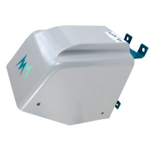
The RG-30+C sensor is a continuous measurement device for the contact-free determination of the water speed and water level of open rivers and channels. It combines two sensors in one system. The first determines the water level by measuring the transit time of a radar signal. The second simultaneously measures the flow velocity of the water surface by means of the Doppler frequency shift.
Due to the contact-free measurement method the RG-30+C can be installed on extension arms or cable ways without costly structural measures under or inside the water. This also has the advantage that the sensor is located outside the danger area of flood events and that it requires no maintenance over many years.
Harnessing the Power of AI and Machine Learning for Precision Measurements and Unmatched Reliability. (optional)
Unlocking new frontiers in data accuracy, the RG-30+C integrates cutting-edge internal AI and machine learning algorithms, ensuring unparalleled precision even in challenging environmental conditions. (optional)
Distinguished by its exceptional robustness, the RG- 30+C stands tall as the instrument of choice, trusted and deployed across thousands of sites spanning over 120 countries worldwide.
Not just a technological marvel, the RG-30+C is also eco-conscious, boasting low-power consumption and seamlessly operating on solar power, making it a sustainable solution for tomorrow’s needs.
Experience the future of measurement technology with the RG- 30+C: Where innovation meets reliability, and precision knows no bounds.
| Self check | Internal self check with code output for each measurement |
| AI Machine learning | Internal Machine learning for velocity, outputted with each measurement. (optional) |
| Data quality | Internal neasurement quality value output with each measurement |
“HailSens represents the culmination of years of dedicated research. As the only hail sensor that seamlessly integrates with hailpad data – the gold standard for scientists worldwide.”


You are currently viewing a placeholder content from YouTube. To access the actual content, click the button below. Please note that doing so will share data with third-party providers.
More InformationYou need to load content from reCAPTCHA to submit the form. Please note that doing so will share data with third-party providers.
More InformationYou need to load content from reCAPTCHA to submit the form. Please note that doing so will share data with third-party providers.
More InformationYou need to load content from reCAPTCHA to submit the form. Please note that doing so will share data with third-party providers.
More Information